 Get Inspired
Wyoming’s best adventure starts in Wind River Country.
Come to get away from the crowds: unplug, unwind and meet Wyoming in the way it’s meant to be met.
Come see what’s waiting for you in Wind River Country.
We ask you to please travel responsibly. Get the latest information.
Start Planning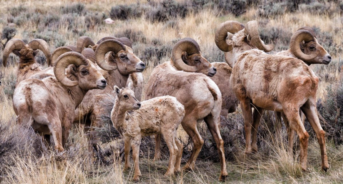
Bighorn sheep rut on Whiskey Mountain. Photo: Bill Sincavage
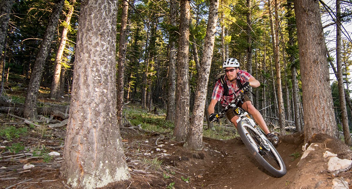
Wind River Country has all kinds of mountain biking trails. Photo: Jared Steinman
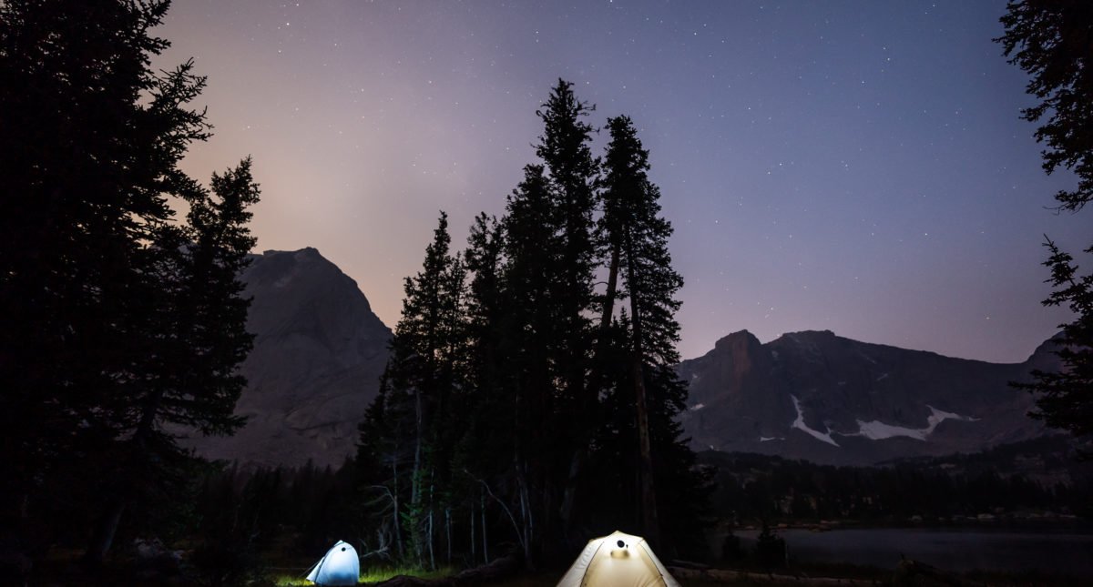
Dusk in the Wind River Range. Photo: Journal of Lost Time
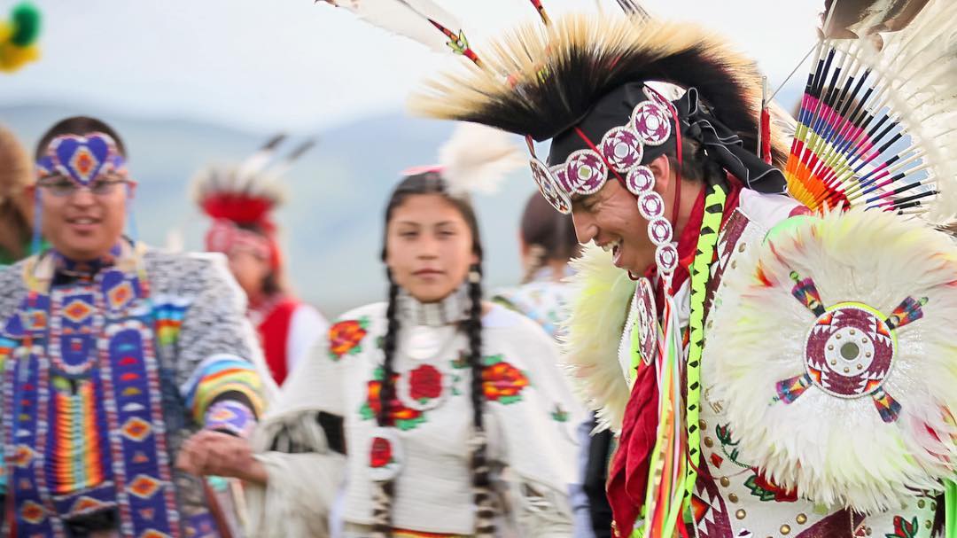
Eagle Spirit Singers and Dancers. Photo: Wyoming Office of Tourism
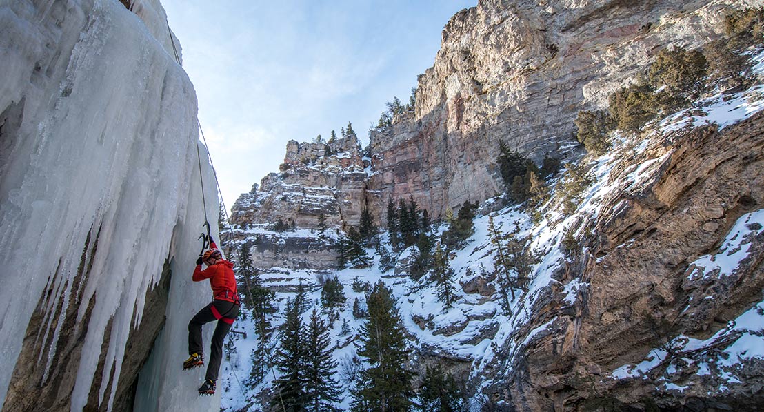
Ice Climbing in Dubois. Photo: Jared Steinman
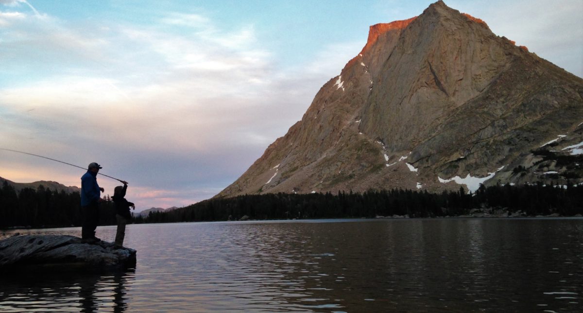
Fishing at Lonesome Lake. Photo: Cinthia Hayford
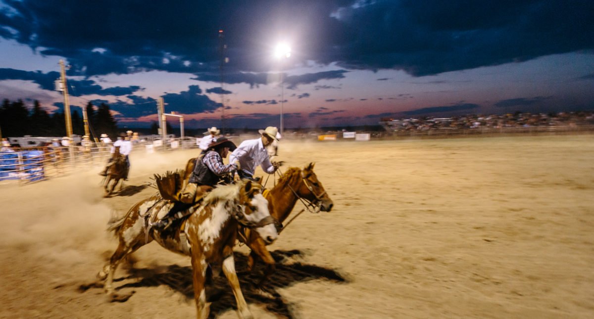
Pioneer Days Rodeo. Photo: Matthew Spaulding
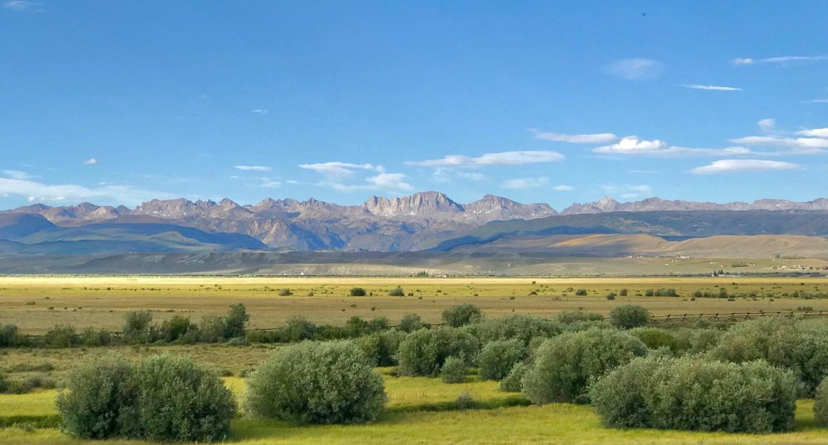
The Wind River Range from the valley. Photo: Wyoming Office of Tourism
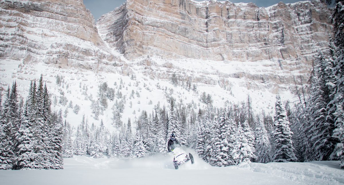
Snowmobiling at Togwotee Pass. Photo: Jeff Shanor
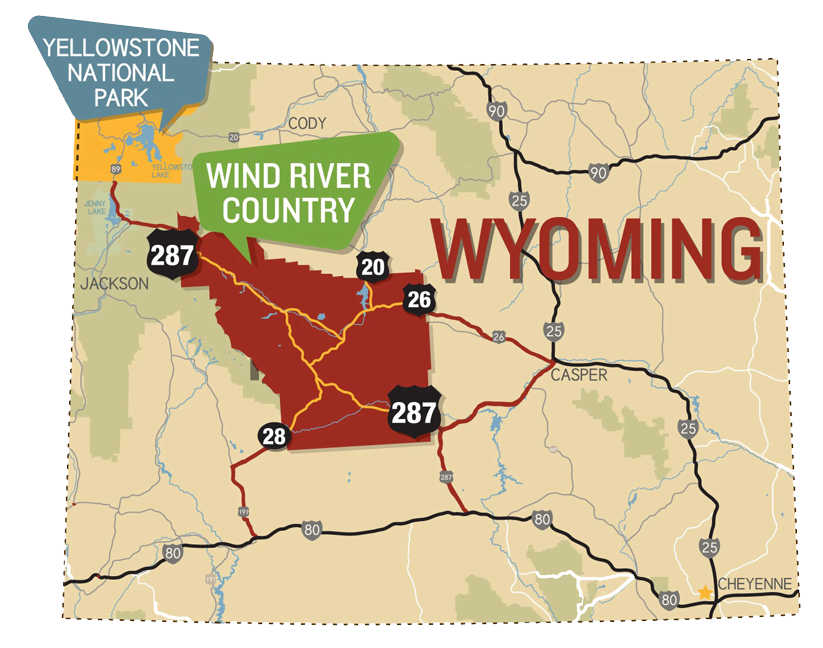
Plan to visit Dubois, Hudson, Lander, Riverton, Shoshoni and the Wind River Indian Reservation.
Travel responsibly
As travel becomes safe again we encourage you to plan ahead, practice physical distancing, play it safe and be kind.
Continue to check our calendar of events for updates and cancellations.
All EventsNOTES FROM THE FIELD BLOG
Visit, or enjoy even a single hike in Wind River Country and you’ll understand why it’s such a great gift to live here. Hiking plays a part in about everything Shelli Johnson does. Read about her favorite hikes.
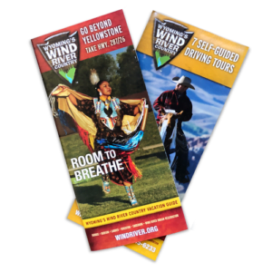
GRAB A VACATION PACKET
We love going beyond the screen when it’s time to plan a trip. There’s such nostalgia in the simple act of spreading out a travel booklet across the kitchen table and letting your imagination run wild while you plan what’s to come. Start Planning
Sign up For our Newsletter
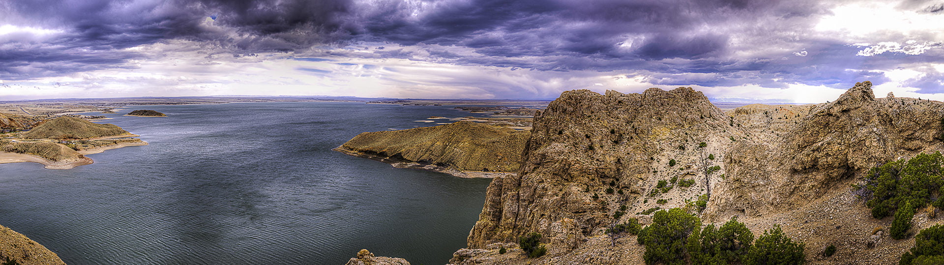
Welcome to Shoshoni, a small town in Wyoming. Shoshoni is known as the gateway to Wind River Canyon, a scenic byway filled with tunnels and breathtaking views. Just outside of Shoshoni find Boysen Reservoir, where you can hook a fish or play on the water.
During its early days, Shoshoni was the home of 23 saloons, two banks, two large mercantiles, livery and feed stables, a lumber yard, drug store, two physicians, lots of lawyers and a newspaper. It also had more lodging and restaurants than any other town of the same size in the state of Wyoming. Back in the day, copper was the most abundant element in the area, but gold and silver were also found here. When it was booming in the early 1900s, there were over 2,000 residents. Today, about 500 people call it home.
Photo: Wyoming Office of Tourism
•
•
•
#WindRiverCountry #Wyoming #ThatsWY #CowboyState #Shoshoni #SmallTown
Want to learn more? Take a peek at this video: https://www.youtube.com/watch?v=jBq6rtd4etg
Photo: Wyoming Office of Tourism
Apr 14

Planning a trip to visit Yellowstone National Park`s geysers, other-worldly terrain and wildlife this spring? Go beyond the park and discover more Wyoming wonders in Wind River Country.
Start planning your trip at the link in our bio.
Photo: Scott Copeland
•
•
•
#WindRiverCountry #Wyoming #ThatsWY #CowboyState #Yellowstone #BeyondYellowstone #Discover
Apr 12
Happy April! Take a peek at all the events going on for this month around Wind River Country.
Be sure to catch the Wind River Farmers Market happening TONIGHT from 4-5:30 p.m. at the Frank B. Wise Business Center in Fort Washakie.
•
•
•
#WindRiverCountry #Wyoming #ThatsWY #CowboyState #LocalEvents
Apr 3
While our mountains and badlands are major draws, Wind River Country also has lots of water to play on. With 600 lakes and reservoirs and 2,000 miles of rivers, it`s easy to add water adventures to your trip. Learn more at the link in our bio.
Photo: David Rule
•
•
•
#WindRiverCountry #Wyoming #ThatsWY #CowboyState
Apr 2
Meet Riverton, Wyoming.
Known as the Rendezvous City, Riverton has a population of just over 10,000 people and is the largest community in the county. Riverton borders the Wind River Indian Reservation and is nestled between mountain ranges and waterways, while it also has a hopping downtown.
Here are a few events to catch in Riverton this summer:
-Riverton Day in the Park (July 13)
-Fremont County Fair (July 27-August 3)
-1838 Mountain Man Rendezvous (July 3-7)
•
•
•
#WindRiverCountry #Wyoming #ThatsWY #CowboyState #WyomingHistory
Mar 29
"Behind every great woman...is another great woman." - Kate Hodges
Before the month ends, we want to take a moment to honor all the bold, strong and amazing women of Wyoming in honor of International Women`s Month.
Photo: Melanie Hoefle
•
•
•
#WindRiverCountry #Wyoming #ThatsWY #CowboyState #Women #InternationalWomensMonth
Mar 27
The truth is that Yellowstone National Park is a bucket-list destination. But if you`re ready to venture beyond the park, come see what Wind River Country has to offer.
Here are a few must-stop spots in Wind River Country:
-Togwotee Pass
-Wind River Wild Horse Sanctuary
-Castle Gardens Petroglyph Site
-National Bighorn Sheep Center
Read more on the best driving tour routes at the link in our bio.
Photo: Wyoming Office of Tourism
•
•
•
#WindRiverCountry #Wyoming #ThatsWY #MirrorImage #CowboyState #Beautiful
Mar 24